150 Marquis Way presents a rare 4.05-acre development opportunity in the heart of Freeport's explosive growth corridor. The property includes more than $475,000 in prepaid water capacity fees that transfer with the sale, offering immediate utility savings and development readiness. A current Development Order for a hotel provides flexibility for hospitality or mixed-use concepts. The site enjoys dual access from Marquis Way/311 and Highway 20 (Blue Ridge Parkway), with the Marquis connector extending west via bridge to Highway 83A South, ensuring strong regional connectivity.
This parcel sits amid major new development activity including Hammock Bay, a 3,000-acre master-planned community with thousands of existing homes and continuous residential expansion, anchors the population growth driving commercial demand along the Hwy 20 corridor. Nearby Owls Head is emerging as a major mixed-use employment and commercial hub, positioned at the crossroads of Hwy 331 and Hwy 20 and supported by new retail and industrial development activity. Further amplifying long-term absorption, Carr Farms represents one of the most significant planned projects in Walton County, with projections of up to 21,000 new homes and roughly 10 million square feet of commercial space at full build-out. Together, these developments form the backbone of Freeport's rapid transformation and create sustained demand for lodging, retail, services, and commercial uses surrounding 150 Marquis Way.
Lot/land
Price cut: $155K (9/14)
$1,995,000
150 Marquis Way, Freeport, FL 32439
--beds
0baths
4.05Acres
Unimproved Land
Built in ----
4.05 Acres Lot
$-- Zestimate®
$--/sqft
$-- HOA
What's special
- 146 days
- 34
- 1
Zillow last checked:
Listing updated:
Listed by:
Dustin Parkman 850-218-8408,
NBI Properties Inc
Source: ECAOR,MLS#: 1004055
Facts & features
Interior
Bedrooms & bathrooms
- Bathrooms: 0
Property
Lot
- Size: 4.05 Acres
- Dimensions: 210 x 840
- Features: Level, Survey Available, Wetlands, Wooded
Details
- Parcel number: 151S19230000380000
- Zoning description: Commercial
Community & HOA
Community
- Subdivision: Lafayette Creek Landing
Location
- Region: Freeport
Financial & listing details
- Tax assessed value: $342,855
- Annual tax amount: $4,371
- Date on market: 5/27/2026
- Road surface type: Paved
Estimated market value
Not available
Estimated sales range
Not available
Not available
Price history
| Date | Event | Price |
|---|---|---|
| 9/14/2026 | Price change | $1,995,000-7.2% |
Source:  ECAOR #1004055 Report a problem | ||
| 5/27/2026 | Listed for sale | $2,150,000+0% |
Source: ECAOR #1004055 Report a problem | ||
| 4/9/2026 | Listing removed | $2,149,000 |
Source: ECAOR #963274 Report a problem | ||
| 2/19/2026 | Price change | $2,149,000+7.5% |
Source: ECAOR #963274 Report a problem | ||
| 2/12/2026 | Price change | $1,999,000-16.7% |
Source: ECAOR #963274 Report a problem | ||
| 8/18/2025 | Price change | $2,399,000-7.7% |
Source: ECAOR #963274 Report a problem | ||
| 7/18/2025 | Price change | $2,600,000+8.3% |
Source: ECAOR #963274 Report a problem | ||
| 6/9/2025 | Price change | $2,400,000+2.1% |
Source: ECAOR #963274 Report a problem | ||
| 5/15/2025 | Price change | $2,350,000+4.4% |
Source: ECAOR #963274 Report a problem | ||
| 4/16/2025 | Listed for sale | $2,250,000+2.3% |
Source: ECAOR #963274 Report a problem | ||
| 4/9/2025 | Listing removed | $2,200,000 |
Source: ECAOR #963274 Report a problem | ||
| 3/26/2025 | Price change | $2,200,000-6.4% |
Source: ECAOR #963274 Report a problem | ||
| 2/24/2025 | Price change | $2,350,000-2.1% |
Source: ECAOR #963274 Report a problem | ||
| 2/10/2025 | Price change | $2,400,000-7.7% |
Source: ECAOR #963274 Report a problem | ||
| 11/18/2024 | Listed for sale | $2,600,000+3385.3% |
Source: ECAOR #963274 Report a problem | ||
| 12/13/2022 | Sold | $74,600-81.3% |
Source: Public Record Report a problem | ||
| 12/30/2021 | Sold | $400,000 |
Source: Public Record Report a problem | ||
Public tax history
| Year | Property taxes | Tax assessment |
|---|---|---|
| 2025 | $4,371 -4.4% | $342,855 -0.2% |
| 2024 | $4,571 -0.2% | $343,667 -0.5% |
| 2023 | $4,580 -5.3% | $345,293 -7.3% |
| 2022 | $4,837 +442.3% | $372,657 +514.9% |
| 2021 | $892 +9.1% | $60,608 +10% |
| 2020 | $817 +3.1% | $55,098 +3% |
| 2019 | $793 | $53,480 +1.1% |
| 2018 | $793 +0.7% | $52,888 +2.7% |
| 2017 | $787 +2.2% | $51,498 -0.7% |
| 2016 | $770 +9.2% | $51,870 -0.4% |
| 2015 | $705 -1.5% | $52,074 -1.1% |
| 2014 | $716 | $52,678 -1.7% |
| 2013 | -- | $53,583 -1.1% |
| 2012 | -- | $54,187 -1.1% |
| 2011 | -- | $54,791 -1.1% |
| 2010 | -- | $55,394 -1.2% |
| 2009 | -- | $56,061 -1.2% |
| 2008 | -- | $56,742 -0.6% |
| 2007 | -- | $57,058 +217.3% |
| 2005 | -- | $17,982 +3% |
| 2004 | -- | $17,458 +1.9% |
| 2003 | -- | $17,132 +2.4% |
| 2002 | -- | $16,730 +1.6% |
| 2001 | -- | $16,467 |
Find assessor info on the county website
Monthly payment
Climate risks
Neighborhood: 32439
Nearby schools
Schools provided by the listing agent
- Elementary: Freeport
- Middle: Freeport
- High: Freeport
Source: ECAOR. This data may not be complete. We recommend contacting the local school district to confirm school assignments for this home.


Similar homes
- $1,400,0002.75 acres16463 Us Highway 331 S, Freeport, FL 32439Lot/Land

 MLS ID #970132, Charlie Hoffner, The Premier Property Group. ECAOR
- $1,325,0004.93 acres960 Western St #20, Freeport, FL 32439Lot/Land
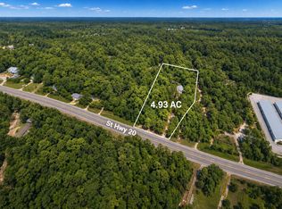 MLS ID #1008099, The Bobby J Team, EXP Realty LLC. ECAOR
- $1,250,0008.63 acresUs Highway 331, Freeport, FL 32439Lot/Land
 MLS ID #1012396, Jon G Harstvedt, Ocean Reef Realty Inc. ECAOR
- $1,250,0002.93 acresSparkleberry Ln, Freeport, FL 32439Lot/Land
 MLS ID #981981, Siegfried Taylor, Park Place Real Estate. ECAOR
- $2,685,00032.23 acres830 Four Mile Rd, Freeport, FL 32439Lot/LandMLS ID #1004690, Jim Ball, Century 21 AllPoints Realty. ECAOR
- $1,350,00010.83 acres000 Jolly Bay Rd, Freeport, FL 32439Lot/LandMLS ID #1010148, James J Adduci, A List Beach Realty LLC. ECAOR
- $1,495,00016.37 acres18 Reserve At Hammock Bay, Freeport, FL 32439Lot/LandMLS ID #990238, Gina M Walker, Hammock Bay. ECAOR
- $1,495,0003.06 acres4440 County Highway 83a W, Freeport, FL 32439Lot/LandMLS ID #1009394, Spears Group, Compass. ECAOR
- $1,475,00020.59 acresFluffy Landing Rd, Freeport, FL 32439Lot/LandMLS ID #961851, Heather E Jeanneret, Southern Beach Realty LLC. ECAOR
- $1,200,0002.06 acresWhitfield Rd, Freeport, FL 32439Lot/LandMLS ID #991017, Spears Group, Compass. ECAOR
- $1,550,0001.88 acres7397 State Highway 20 W, Freeport, FL 32439Lot/LandMLS ID #953331, Darren A Larson, Harmony Beach Realty. ECAOR
- $1,400,0000.75 acres2744 Bay Grove Rd, Freeport, FL 32439Lot/LandMLS ID #1013886, Spears Group, Compass. ECAOR
- $1,595,00020 acresNellie Dr, Santa Rosa Beach, FL 32459Lot/LandMLS ID #1012855, Jim Ball, Century 21 AllPoints Realty. ECAOR
- $1,500,00015 acres0 Indian Woman Rd, Santa Rosa Beach, FL 32459Lot/LandMLS ID #992505, Heather N Jenkins, EXP Realty LLC. ECAOR
- $1,525,0005.86 acres760 Old Ferry Rd, Pt Washington, FL 32459Lot/LandMLS ID #1000678, Wells R Buzzett, Christies International Real Estate Emerald Coast. ECAOR
- $2,500,00010 acres184 N Eden Park Dr, Santa Rosa Beach, FL 32459Lot/LandMLS ID #998523, Kevin Granberry, RE/MAX by the Sea. ECAOR
- $1,495,0002.2 acres10 N County Highway 395, Pt Washington, FL 32459Lot/LandMLS ID #995042, Greg L Smith, Corcoran Reverie SRB. ECAOR
- $1,000,0001 acreUs Highway 331, Freeport, FL 32439Lot/LandMLS ID #999375, Marcie L Campbell, Tide & Timber Properties. ECAOR
- $1,675,0002.39 acres22 Old Winston Cir, Pt Washington, FL 32459Lot/LandMLS ID #1004230, Bridgett L Hall-Cotton, A List Beach Realty LLC. ECAOR
