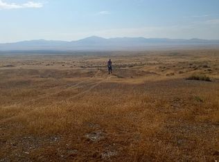
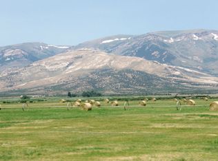
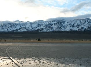
This lot is one of the most beautiful and spectacular areas of the state! The parcel is located in Western Box Elder County in Northwestern Utah. This area is know for its diverse landscapes, friendly people and rich western history. This area is a secluded basin where the dramatic Sawtooth (only 150 miles away) and Pilot Mountains slope down to the shores of the Great Salt Lake. Spectacular salt flats are located in this area along the shores of the Great Salt Lake and harbor a vibrant ecosystem that is home to a variety of rare migratory bird species. The lake itself is a great place for sailing, kayaking, or swimming. The property is located 135 miles from the quaint ranching community of Grouse Creek. Grouse Creek is steeped in history and to this day it is reminiscent of a time when the west was still wild. Today most visitors come for the scenery as well as deer and bird hunting. Other nearby communities include the town of Wendover (40 miles away), home of the Bonneville Speedway and many land-speed records, and Brigham City (205 miles away). SIZE: 20.00 Acres APN: 01-116-0004 LEGAL DESCRIPTION: THE NORTH HALF OF THE SOUTHEAST QUARTER OF THE NORTHWEST QUARTER OF SECTION 36, TOWNSHIP 4 NORTH, RANGE 18 WEST, SALT LAKE BASE AND MERIDIAN. RESERVING TO THE STATE OF UTAH, ALL COAL AND OTHER MINERALS, IN THE ABOVE LANDS, AND TO IT, OR PERSONS AUTHORIZED BY IT, THE RIGHT TO PROSPECT FOR, MINE AND REMOVE COAL AND OTHER MINERSALS FROM THE SAME, UPON COMPLIANCE WITH THE CONDITIONS AND SUBJECT TO THE LIMITATIONS OF TITLE 65, CHAPTER 1, UTAH CODE ANNOTATED, 1953, AND AMENDMENTS THERETO. COUNTY: Box Elder GENERAL LOCATION: 40 Miles from Wendover, UT DRIVING DIRECTIONS: From Wendover, UT (Interstate-80) take the exit for Bonneville Speedway (Exit 4). Turn Left off the off-ramp and travel North on Salt Flats Road for 1.5 miles to the intersection with Pilot Peak Road. Bear Left onto Pilot Peak Road and travel Northwest for .09 of a mile to th intersection with a Southwestern-Northeastern running road Silver Island Mountain Loop. Turn Right on Silver Island Mountain Loop and travel Northeast on this road for 9.3 miles. This road will take you along the Eastern edge of the Southern Silver Island mountains. At this point there is a pass between the two mountains and an intersection with a Northwestern running road. Turn Left on this road and travel Northwest for 4.1 miles to the intersection with a North-South running road that runs along the Western side of the Silver Island Mountains. Turn Right on this road and travel North for 8.64 miles. At this point (where the road begins heading East) there is a 4 wheel-drive road that intersects from the Left. Bear Left on this road and travel Northeast for .66 of a mile. At this point the 4 wheel-drive trail intersects the Donner-Reed Trail. Turn Left onto the Donner-Reed Trail and head due West for 2.24 miles. At this point the property is located approximately 0.56 of a mile due North. Roads leading to the property may not be completed and/or be in poor condition and road signs may not be present. All distances are approximate. We are unable to note clear driving directions as we have not visited the property. GENERAL ELEVATION: 4300 feet ZONING: Vacant-Recreational ROADS: Dirt PROPERTY TAX: Approximately $5/year. All property taxes are current. TIME LIMIT TO BUILD: N/A ASSOCIATION DUES: N/A TYPE OF TERRAIN: Flat to rolling with beautiful views COUNTY MAP: http://gis.boxeldercounty.org/flexviewers/webmap/?form_version=2 enter Parcel ID Number: 01-116-0004 Financing Terms: Calculate your Monthly Payment at http://www.zillow.com/mortgage-calculator/ with (Unmark property taxes and insurance field): 10% Down Payment 1-3 Years - No Interest 5 Years - 3% Interest 10 Years - 5% Interest 20 Years - 7% Interest 30 Years - 9% Interest I'm Negotiable!! Bring All Offers!! I have not seen this property.
This property is not currently displayed as for sale or rent on Zillow. This may be different from what's on other websites or public sources.