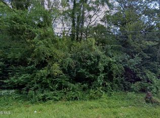
Great opportunity to own a 0.22-acre (2 adjacent parcels) located in a residential area. This unimproved lot offers potential for future residential use, subject to zoning, building requirements, and approval by the appropriate local authorities. Conveniently situated near established homes and neighborhood amenities. Buyer to verify all utilities, zoning, building restrictions, and intended use. 2 Parcels - 310 N McCord (Parcel ID: 6542954) and 314 N McCord (Parcel ID 6542957) The land is zoned Neighborhood Commercial (C-1) District- residential use just needs a special use permit.
Lot/land
$10,000
310 N McCord Rd, Toledo, OH 43615
--beds
0baths
10,018Square Feet
Unimproved Land
Built in ----
10,018 Square Feet Lot
$-- Zestimate®
$--/sqft
$-- HOA
What's special
- 37 days
- 181
- 9
Zillow last checked:
Listing updated:
Listed by:
Tamara Wheeler 419-290-2813,
The Danberry Co
Source: NORIS,MLS#: 10013747
Facts & features
Interior
Bedrooms & bathrooms
- Bathrooms: 0
Video & virtual tour
Property
Features
- Has view: Yes
- View description: Trees/Woods
Lot
- Size: 10,018 Square Feet
- Dimensions: 40X126 and 40x126
Details
- Additional parcels included: 314 N McCord; lot 6542957
- Parcel number: 6542954
Utilities & green energy
- Sewer: Public Sewer
- Water: Public
Community & HOA
Community
- Subdivision: Devonshire Lane
HOA
- Has HOA: No
Location
- Region: Toledo
Financial & listing details
- Tax assessed value: $2,300
- Annual tax amount: $54
- Date on market: 9/22/2026
- Listing terms: Cash,Conventional
Estimated market value
Not available
Estimated sales range
Not available
Not available
Price history
| Date | Event | Price |
|---|---|---|
| 9/22/2026 | Listed for sale | $10,000 |
Source: NORIS #10013747 Report a problem | ||
Public tax history
| Year | Property taxes | Tax assessment |
|---|---|---|
| 2025 | $54 +9.5% | $805 |
| 2024 | $49 +18.1% | $805 +35.3% |
| 2023 | $42 -0.1% | $595 |
| 2022 | $42 +6.4% | $595 |
| 2021 | $39 +11% | $595 +21.4% |
| 2020 | $35 +2.3% | $490 |
| 2019 | $35 +1.6% | $490 |
| 2018 | $34 +28.5% | $490 +40% |
| 2017 | $26 -0.9% | $350 -65% |
| 2016 | $27 +0.1% | $1,000 |
| 2015 | $27 +5.9% | $1,000 +185.7% |
| 2014 | $25 | $350 |
| 2013 | $25 +8.3% | $350 |
| 2012 | $23 +6.7% | $350 |
| 2011 | $22 +0.3% | $350 |
| 2010 | $22 +6.6% | $350 |
| 2009 | $20 -4% | $350 -10.3% |
| 2008 | $21 +4.7% | $390 |
| 2007 | $20 +1.6% | $390 |
| 2006 | $20 -12.3% | $390 -15.2% |
| 2004 | $23 +3.9% | $460 |
| 2003 | $22 -89.3% | $460 -88.9% |
| 2002 | $205 -46.1% | $4,130 |
| 2000 | $381 | $4,130 |
Find assessor info on the county website
Monthly payment
Climate risks
Neighborhood: 43615
Nearby schools
Schools provided by the listing agent
- Elementary: Hawkins
- High: Rogers
Source: NORIS. This data may not be complete. We recommend contacting the local school district to confirm school assignments for this home.

Similar homes
- $12,5000.32 acres883 N McCord Rd, Toledo, OH 43615Lot/Land
 MLS ID #10013749, Tamara Wheeler, The Danberry Co. NORIS
- $13,5002,613 sqft4 Nevada St, Toledo, OH 43605Lot/Land
 MLS ID #10014272, Beth A. Rose, Beth Rose Real Estate & Auctio. NORIS
- $12,0003,920 sqft39 E Streicher St, Toledo, OH 43608Lot/Land
 MLS ID #10008813, Nicholas Novinsky, Key Realty. NORIS
- $15,0000.78 acres2815 N Ontario St, Toledo, OH 43611Lot/Land
 MLS ID #10001581, Adam W. Crane, Howard Hanna. NORIS
- $11,0000.46 acres589 & 595 Marquette Dr, Erie, MI 48133Lot/Land
 MLS ID #50140028, Spurgeon Johnson, Coldwell Banker Haynes R.E. in Monroe. MiRealSource
