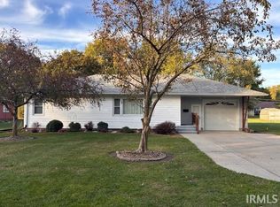
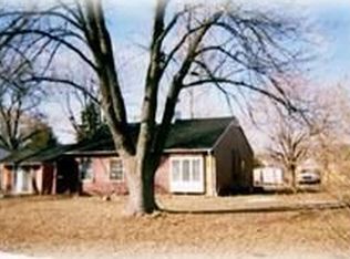
This 1608 square foot single family home has 3 bedrooms and 1.0 bathrooms. This home is located at 312 E Maple St, Kentland, IN 47951.
Auction
Street View

Est. $155,500
312 E Maple St, Kentland, IN 47951
3beds
1baths
1,608sqft
Single Family Residence
Built in 1955
0.31 Acres Lot
$155,500 Zestimate®
$--/sqft
$-- HOA
Overview
- 7 days
- 67
- 0
Zillow last checked:
Listed by:
Customer Service,
ServiceLink Auction
Source: ServiceLink Auction
Facts & features
Interior
Bedrooms & bathrooms
- Bedrooms: 3
- Bathrooms: 1
Interior area
- Total structure area: 1,608
- Total interior livable area: 1,608 sqft
Property
Lot
- Size: 0.31 Acres
Details
- Parcel number: 561621111026000011
- Special conditions: Auction
Construction
Type & style
- Home type: SingleFamily
- Property subtype: Single Family Residence
Condition
- Year built: 1955
Community & HOA
Location
- Region: Kentland
Financial & listing details
- Tax assessed value: $131,700
- Annual tax amount: $1,093
- Date on market: 11/13/2026
- Lease term: Contact For Details
Estimated market value
$155,500
$131,000 - $177,000
$1,370/mo
Public tax history
| Year | Property taxes | Tax assessment |
|---|---|---|
| 2025 | $1,093 +10.2% | $131,700 +6.5% |
| 2024 | $993 +7.5% | $123,700 +8.4% |
| 2023 | $924 +29.5% | $114,100 +10.8% |
| 2022 | $713 +4.5% | $103,000 +17.8% |
| 2021 | $682 +15.3% | $87,400 +3.1% |
| 2020 | $592 -20.1% | $84,800 +1.7% |
| 2019 | $741 +237.1% | $83,400 -3.9% |
| 2018 | $220 +0.8% | $86,800 +9.2% |
| 2017 | $218 +111.4% | $79,500 -0.9% |
| 2016 | $103 +2.1% | $80,200 +20.1% |
| 2014 | $101 +1.8% | $66,800 +1.8% |
| 2013 | $99 -0.5% | $65,600 +0.6% |
| 2012 | $100 +2.7% | $65,200 +3.8% |
| 2011 | $97 -42.3% | $62,800 -15% |
| 2010 | $168 +1.3% | $73,900 -2% |
| 2009 | $166 -52.7% | $75,400 -7.8% |
| 2007 | $351 -34.6% | $81,800 +4.3% |
| 2006 | $537 | $78,400 |
| 2005 | -- | $78,400 |
Find assessor info on the county website