Description
4.27 Acres Industrial Acres Available
Tough zoning to find in Acton, not too much M1.
Lot has easy Ingress / Egress to lot off two paved streets, Gillespie on one side Syracuse on the other.
Lot Very Visible from Soledad Canyon Road
Topo Is Level to Very Gentle Slope -all useable
Zoned M1 Light Industrial (IL)
Electric on Property Along with Producing Water Well
Very pleasing to the eye piece of Property
Lot/land
Listed by: Realty Executives SCV • Bob Loner • 661-250-8670
$1,395,000
3362 Syracuse Ave, Acton, CA 93510
--beds
--baths
4.27Acres
Unimproved Land
Built in ----
4.27 Acres Lot
$-- Zestimate®
$--/sqft
$-- HOA
What's special
- 568 days
- 15
- 0
Zillow last checked:
Listing updated:
Listed by:
Bob Loner DRE #00648540 661-250-8670,
Realty Executives SCV
Source: CRMLS,MLS#: SR25087438 Originating MLS: California Regional MLS
Facts & features
Property
Features
- Fencing: Chain Link
- Has view: Yes
- View description: Panoramic
Lot
- Size: 4.27 Acres
- Dimensions: 282 x 630
- Features: Paved, Value In Land
Details
- Parcel number: 3208019009
- Zoning: M-1 (IL)
- Zoning description: Light Industrial
- Special conditions: Standard
Utilities & green energy
- Water: Private, Shared Well
- Utilities for property: Overhead Utilities
Community & HOA
Community
- Features: Rural
- Subdivision: Custom Acton (Cacto)
Location
- Region: Acton
Financial & listing details
- Tax assessed value: $174,147
- Date on market: 4/21/2025
- Cumulative days on market: 568 days
- Listing terms: Cash
Estimated market value
Not available
Estimated sales range
Not available
Not available
Price history
| Date | Event | Price |
|---|---|---|
| 4/21/2025 | Listed for sale | $1,395,000 |
Source:  CRMLS #SR25087438 Report a problem | ||
Public tax history
| Year | Property taxes | Tax assessment |
|---|---|---|
| 2026 | -- | $174,147 +2% |
| 2025 | $2,349 +6.1% | $170,733 +2% |
| 2024 | $2,214 +7.1% | $167,386 +2% |
| 2023 | $2,066 +1.9% | $164,104 +2% |
| 2022 | $2,028 +1.5% | $160,887 +2% |
| 2021 | $1,998 +1.1% | $157,733 +1% |
| 2020 | $1,976 | $156,116 +2% |
| 2019 | $1,976 -0.3% | $153,055 +2% |
| 2018 | $1,981 | $150,054 +2% |
| 2017 | $1,981 +1.8% | $147,112 +2% |
| 2016 | $1,946 +5.8% | $144,228 +1.5% |
| 2015 | $1,840 +0.6% | $142,062 +2% |
| 2014 | $1,829 | $139,280 +2.5% |
| 2012 | -- | $135,933 +2% |
| 2011 | -- | $133,268 +0.8% |
| 2010 | -- | $132,272 -0.2% |
| 2009 | -- | $132,587 +2% |
| 2008 | -- | $129,988 +2% |
| 2007 | -- | $127,440 +2% |
| 2006 | -- | $124,942 |
| 2005 | -- | $124,942 +4% |
| 2004 | -- | $120,092 +1.9% |
| 2003 | -- | $117,891 -14.6% |
| 2002 | -- | $138,109 +4% |
| 2000 | -- | $132,748 |
Find assessor info on the county website
Monthly payment
Climate risks
Neighborhood: 93510
Similar homes
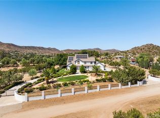
- $995,0003.19 acres0 Gillespie Ave Lot 15, Acton, CA 93510Lot/Land
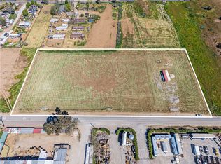 MLS ID #SR26059033, Brian Palmer, RE/MAX Gateway. CRMLS
- $1,349,00031.1 acres0 Sierra Hwy #25, Acton, CA 93510Lot/Land
 MLS ID #SR26128572, Santos Aleman, Santos Aleman Real Estate. CRMLS
- $850,0006.12 acres3943 Sierra Hwy, Acton, CA 93510Lot/Land
 MLS ID #25606221, Efrayem Soliman DRE # 00815930, Soliman Realty. CLAW
- $900,0008.31 acres0 Crown Valley Rd #24, Acton, CA 93510Lot/Land
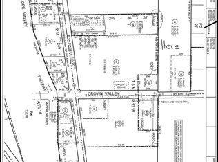 MLS ID #DW26066526, Gregorio Isiordia, MC Pacific Homes. CRMLS
Local buyer's agents are ready to help
