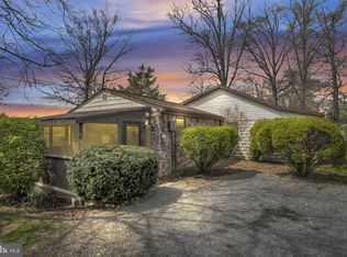
This 0.29-acre lot in Upper Frankford Township offers approximately 80 feet of frontage on Conodoguinet Creek. The property has its own driveway and a second driveway shared with the adjoining property. The raised cabin-style structure has been used for storage for about 10 years. The property has a shared well and an exterior electric hookup from prior service. Current electric service is unverified. The structure has no heat or bathroom, and there is no septic system. Buyers should verify shared well rights, septic feasibility, and permitted uses. Creek access needs cleared.
Lot/land
$28,000
405 Potato Rd, Carlisle, PA 17015
--beds
--baths
0.29Acres
Unimproved Land
Built in ----
0.29 Acres Lot
$71,800 Zestimate®
$--/sqft
$-- HOA
What's special
Own driveway
- 1 day
- 107
- 8
Zillow last checked:
Listing updated:
Listed by:
Madison Nunemaker 717-433-3248,
Real of Pennsylvania 8554500442
Source: Bright MLS,MLS#: PACB2060340
Facts & features
Property
Features
- Has view: Yes
- View description: Creek/Stream
- Has water view: Yes
- Water view: Creek/Stream
- Body of water: Conodoguinet Creek
- Frontage length: Water Frontage Ft: 80
Lot
- Size: 0.29 Acres
Details
- Parcel number: 43060029018
- Zoning: RESIDENTIAL
- Special conditions: Standard
Utilities & green energy
- Sewer: No Sewer System
- Water: Well, Private/Community Water
Community & HOA
HOA
- Has HOA: No
Location
- Region: Carlisle
- Municipality: UPPER FRANKFORD TWP
Financial & listing details
- Tax assessed value: $30,300
- Annual tax amount: $780
- Date on market: 11/11/2026
- Listing agreement: Exclusive Agency
- Listing terms: Cash,Bank Portfolio
- Ownership: Fee Simple
Estimated market value
$71,800
$54,000 - $94,000
$1,124/mo
Price history
| Date | Event | Price |
|---|---|---|
| 11/11/2026 | Listed for sale | $28,000 |
Source:  Bright MLS #PACB2060340 Report a problem | ||
Public tax history
| Year | Property taxes | Tax assessment |
|---|---|---|
| 2026 | $585 +0.8% | $30,300 |
| 2025 | $581 +2.8% | $30,300 |
| 2024 | $565 +1.3% | $30,300 |
| 2023 | $558 +2.1% | $30,300 |
| 2022 | $546 +57.8% | $30,300 +57.8% |
| 2021 | $346 +5% | $19,200 |
| 2020 | $330 +580.8% | $19,200 |
| 2019 | $48 -84.8% | $19,200 |
| 2018 | $318 | $19,200 |
| 2017 | -- | $19,200 |
| 2016 | -- | $19,200 |
| 2015 | -- | $19,200 |
| 2014 | -- | $19,200 |
| 2013 | -- | $19,200 |
| 2012 | -- | $19,200 |
| 2011 | -- | $19,200 +20.5% |
| 2010 | -- | $15,930 |
| 2009 | -- | $15,930 |
| 2008 | -- | $15,930 |
| 2007 | -- | $15,930 |
| 2006 | -- | $15,930 |
| 2005 | -- | $15,930 +94.7% |
| 2004 | -- | $8,180 |
| 2003 | $19 | $8,180 |
| 2000 | -- | $8,180 |
Find assessor info on the county website
Monthly payment
Climate risks
Neighborhood: 17015
Nearby schools
Schools provided by the listing agent
- High: Big Spring
- District: Big Spring
Source: Bright MLS. This data may not be complete. We recommend contacting the local school district to confirm school assignments for this home.
Similar homes
- $30,0007,405 sqftParadise Dr, Carlisle, PA 17015Lot/Land

 MLS ID #PACB2055410, DAVID HOOKE, Keller Williams of Central PA. Bright MLS
- $30,0007,405 sqftParadise Dr, Carlisle, PA 17015Lot/Land
 MLS ID #PACB2055402, DAVID HOOKE, Keller Williams of Central PA. Bright MLS
- $40,0002.21 acresLOT Pine Grove Rd #21, New Bloomfield, PA 17068Auction
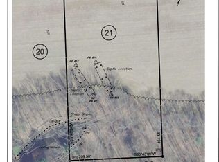 MLS ID #PAPY2010076, J. Meryl Stoltzfus, Beiler-Campbell Realtors-Quarryville. Bright MLS
- $40,0002.2 acresLOT Pine Grove Rd #26, New Bloomfield, PA 17068Auction
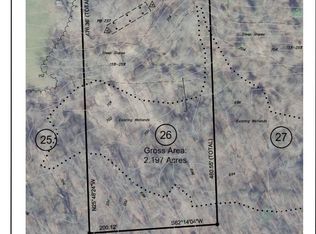 MLS ID #PAPY2010020, J. Meryl Stoltzfus, Beiler-Campbell Realtors-Quarryville. Bright MLS
- $40,0002.21 acresLOT Pine Grove Rd #27, New Bloomfield, PA 17068AuctionMLS ID #PAPY2010022, J. Meryl Stoltzfus, Beiler-Campbell Realtors-Quarryville. Bright MLS
- $40,0003.98 acres17 Cherry Hill Dr, Hustontown, PA 17229Lot/LandMLS ID #PAHU2024720, Alexis Thompson, Lake & Country Real Estate. Bright MLS
- $40,0003.63 acresLOT 32 Okefenoke Rd, New Bloomfield, PA 17068AuctionMLS ID #PAPY2010092, J. Meryl Stoltzfus, Beiler-Campbell Realtors-Quarryville. Bright MLS
- $40,0002.64 acresLOT Pine Grove Rd #23, New Bloomfield, PA 17068AuctionMLS ID #PAPY2010080, J. Meryl Stoltzfus, Beiler-Campbell Realtors-Quarryville. Bright MLS
- $40,0003.72 acresLOT 34 Okefenoke Rd, New Bloomfield, PA 17068AuctionMLS ID #PAPY2010096, J. Meryl Stoltzfus, Beiler-Campbell Realtors-Quarryville. Bright MLS
- $40,0003.76 acresLOT Pine Grove Rd, New Bloomfield, PA 17068AuctionMLS ID #PAPY2010036, J. Meryl Stoltzfus, Beiler-Campbell Realtors-Quarryville. Bright MLS
- $39,9001 acre0 Mountain Rd, Marysville, PA 17053Lot/LandMLS ID #PAPY2009590, Gerald Nolt, Beiler-Campbell Realtors-Quarryville. Bright MLS
- $41,2001.55 acres2 McCulloch Rd, Shippensburg, PA 17257Lot/LandMLS ID #PACB2054670, Tony Lopes, Iron Valley Real Estate of Central PA. Bright MLS
- $15,0000.49 acres695 Mount Tabor Rd, Gardners, PA 17324Lot/LandMLS ID #PAAD2024698, David Todd, Berkshire Hathaway HomeServices Homesale Realty. Bright MLS
