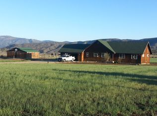
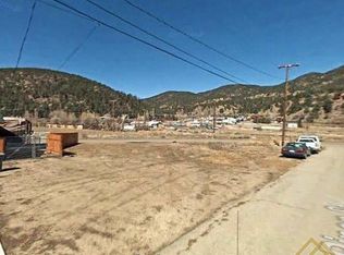
This lot is an incredibly beautiful parcel with spectacular views. You hardly see acreage this large close to Los Angeles at such a low price. These 52.66 south-facing acres with breathtaking views are situated in Frazier Park below San Emigdio Mountain and Antimony Peak, in the vicinity of the fabled Lost Padre Gold Mine and the Pine Mountain Club. This land is in Kern County, about 90 minutes north of Los Angeles and about 5 miles west of the Tejon Pass. Originally part of the Spanish "Rancho San Emigdio" land grant of 1842 in the 1900's this property was mined for quartz and gold as well as iron and tin. The mining claim was then "patented" into a traditional land deed in 1906. The property backs up to BLM / USGS and access is available through it. South-facing slopes are the ideal spot for gardens and for the cultivation of sensitive plants, just think of what you can grow on this rich soil land. All utilities are present: road, water, electricity, phone services. TAXES: $217.66 TIME LIMIT FOR BUILDING: None ASSOCIATION DUES: None LEGAL DESCRIPTION: The official legal description of the parcel, APN 256-190-240, is as follows: "That certain lode mining claim or premises known as the United States Consolidated Quartz Mine, consisting of United States Mine, America Mine, Independence Iron Mine and Lost Watch Iron Mine lode mining claims designated by the Surveyor-General as Lot No. 4120 embracing a portion of Section 17, Township 9 North, Range 21 West, San Bernardino Base and Meridian, in San Emidio Mining District in the county of Kern, State of California, as particularly described in Patent issued to The Iron and Tin Mining and Smelting Company dated January 24, 1906, recorded April 18, 1905 in Book 13, Page 427 of Patents, records of Kern County, California." COUNTY LAND INFO: http://assessor.co.kern.ca.us/propertysearch/ Property Search Form>>APN>>enter parcel number: 25619024>>Search Kern County Online Mapping System: http://esps.kerndsa.com/gis/gis-disclaimer click Agree>>Launch Map Viewer>>Locate a Parcel by APN>>25619024 GOOGLE MAP: http://maps.google.com/maps?hl=en&newwindow=1&client=firefox-a&rls=org.mozilla:en-US:official&gbv=2&gl=us&q=34.859917,+-119.14586 GPS COORDINATES:The coordinates are for several corners from the northernmost point and going clockwise. 1. 34.861861,-119.14581 (WGS84) 2. 34.86125,-119.14394 (WGS84) 3. 34.858583,-119.14181 (WGS84) 4. 34.858222,-119.14347 (WGS84) 5. 34.858194,-119.14639 (WGS84), 6. 34.858889,-119.14686 (WGS84), 7. 34.858194,-119.14786 (WGS84) 8. 34.858167,-119.15086 (WGS84) 9. 34.860194,-119.14794 (WGS84) 10. 34.860667,-119.14964 (WGS84) Google Earth.com: 34.859917, -119.14586 DIRECTIONS: From Frazier Park intersection of Frazier Mountain Park Road and Monterrey Trail, approximately 4 miles from the Frazier Park Exit on US 5 head west on Frazier Mountain Park Road for 3.3 miles to the turnoff for Cuddy Valley Road. Turn right onto Cuddy Valley Road and continue west for 5.2 miles. At this point the road will continue to the north as Mil Potrero HWY SR 95 for 12.9 miles heading towards the Pine Mountain Club. Turn right onto Nesthorn Way (not Nesthorn Place!) and follow it to the northeast for .2 of a mile. At this point there is a turnoff for a mountain road headed to the northeast (just to the west of a house). Turn onto this road and follow it to the northeast for .27 mile and the southeastern corner of the property is 1,085 fee due north on the left (north) side of the road. Roads leading to the property may have not been completed or may be in poor condition and road signs may not be present. All road distances are approximate. Financing Terms: Calculate your Monthly Payment at http://www.zillow.com/mortgage-calculator/ with (Unmark property taxes and insurance field): 10% Down Payment 1-3 Years - No Interest 5 Years - 3% Interest 10 Years - 5% Interest 20 Years - 7% Interest 30 Years - 9% Interest
This property is not currently displayed as for sale or rent on Zillow. This may be different from what's on other websites or public sources.