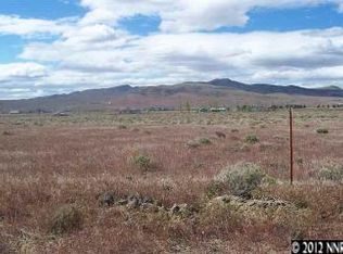
In the rural community of Silver Springs, this buildable lot is available and ready for development. With views all around and plenty to do, this property would be great for living the simpler life. Silver Springs Beach is just a 6 minute drive, located on Lake Lahontan and the mountainous view is always available. Adjacent to the Union Pacific Railroad, the oldest operating Class I railroad in the U.S., a piece of history is right nearby! Silver Springs Airport is also nearby, it is a full-service airport with LPV navigation approach, AV fuel, Jet A fuel, AWOS 2, hangars, 6000 x 75 lighted runway, with full length taxiway, and large tarmac. Ready to check it out? Contact us today! Please note, these are nearby photos. Our photographer is working to get to the area. Prop ID: 017-084-11 Size of Lot (or LOT AREA): 280,091 Acreage Size: 6.43 ac Tax Assessment Year: 2020 Yearly Taxes: $120.94 Zone Type: RR-3 (Third Rural Residential - 5 acre minimum) Mobile Homes: Manufactured Home can be placed anywhere in Lyon County as long as there are no CC&Rs or Deed Restrictions in place that might prohibit them. RV: RVs are only allowed as a temporary residence on a parcel that has been issued a Building Permit for a primary residence. As long as the Building Permit is kept current with regular inspections showing progress on the construction, the RV can be used as a residence but will have to be disconnected from the septic prior to the primary home receiving a Certificate of Occupancy. Sewer: Septic can be installed. Water: Well would be required. Electricity: NV Energy is the local electrical service provider in this area. Terrain: Property is gently rolling. Road Access: Access is from Fir Avenue to the north of the subject parcel, then south onto Railroad Street. Access is off of Spooner St. Fir Ave. to Railroad St. to Spooner St. Flood Zone: There are no identified floodplains on this parcel. HOA Information: None found. Abbreviated Legal Description: Lot 126 MOUNTAIN VIEW 2 Complete Legal Description: Lot 126 as shown on the Official Map of MOUNTAIN VIEW SUBDIVISION, NO. 2, recorded in the Official Records of Lyon County, Nevada, on 6/5/1951, as Document No. 59046, and as shown on the Amended Map of MOUNTAIN VIEW SUBDIVISION NO. 2, recorded in the Official Records of Lyon County, Nevada on November 8, 1954, as Document No. 66540. GPS Coordinates: Center: 39.362969, -119.220545 NW: 39.363429, -119.221939 NE: 39.363433, -119.219044 SW: 39.362528, -119.222152 SE: 39.362514, -119.219040
This property is not currently displayed as for sale or rent on Zillow. This may be different from what's on other websites or public sources.