This is a 1796 square foot, 2.0 bathroom, single family home. This home is located at 7290 Simms Landing Rd, Port Tobacco, MD 20677.
Auction
Street View

Est. $478,200
7290 Simms Landing Rd, Port Tobacco, MD 20677
--beds
2baths
1,796sqft
Single Family Residence
Built in 1977
2.5 Acres Lot
$478,200 Zestimate®
$--/sqft
$-- HOA
Overview
- 8 days
- 51
- 2
Zillow last checked:
Listed by:
Customer Service,
ServiceLink Auction
Source: ServiceLink Auction
Facts & features
Interior
Bedrooms & bathrooms
- Bathrooms: 2
Interior area
- Total structure area: 1,796
- Total interior livable area: 1,796 sqft
Property
Lot
- Size: 2.5 Acres
Details
- Parcel number: 01015923
- Special conditions: Auction
Construction
Type & style
- Home type: SingleFamily
- Property subtype: Single Family Residence
Condition
- Year built: 1977
Community & HOA
Location
- Region: Port Tobacco
Financial & listing details
- Tax assessed value: $400,200
- Annual tax amount: $266
- Date on market: 11/6/2026
- Lease term: Contact For Details
Estimated market value
$478,200
$454,000 - $502,000
$2,759/mo
Public tax history
| Year | Property taxes | Tax assessment |
|---|---|---|
| 2026 | $266 -95% | $400,200 +7.8% |
| 2025 | $5,334 +8.4% | $371,200 +8.5% |
| 2024 | $4,922 +25.4% | $342,200 +9.3% |
| 2023 | $3,924 +16.1% | $313,200 |
| 2022 | $3,379 -8.4% | $313,200 +6.3% |
| 2021 | $3,691 +3.3% | $294,533 +3.3% |
| 2020 | $3,574 -4.3% | $285,200 |
| 2019 | $3,735 +0.6% | $285,200 +1.1% |
| 2018 | $3,714 +0.6% | $282,000 +0.6% |
| 2017 | $3,693 +13.4% | $280,400 +2.7% |
| 2016 | $3,258 | $272,967 +2.8% |
| 2015 | $3,258 | $265,533 +2.9% |
| 2014 | $3,258 | $258,100 |
| 2013 | -- | $258,100 |
| 2012 | -- | $258,100 -14.4% |
| 2011 | -- | $301,510 |
| 2010 | -- | $301,510 |
| 2009 | -- | $301,510 -4% |
| 2008 | -- | $314,150 +17.9% |
| 2007 | -- | $266,480 +21.8% |
| 2006 | -- | $218,810 +27.9% |
| 2005 | -- | $171,140 +4.3% |
| 2004 | -- | $164,030 +4.5% |
| 2003 | -- | $156,920 +4.7% |
| 2002 | -- | $149,810 |
| 2001 | -- | $149,810 |
Find assessor info on the county website
Climate risks
Neighborhood: 20677
- $544,5004 bd4 ba3.3k sqft7310 Simms Landing Rd, Port Tobacco, MD 20677Off Market
- $729,4005 bd4 ba2.9k sqft7270 Simms Landing Rd, Port Tobacco, MD 20677Off Market
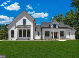
- $454,2004 bd3 ba2.3k sqft7330 Simms Landing Rd, Port Tobacco, MD 20677Off Market
- $643,900-- bd2 ba2.5k sqft7250 Simms Landing Rd, Port Tobacco, MD 20677Off Market
