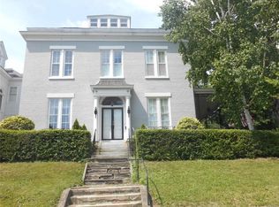
The Montcalm Park Historic District is located on the west bank of the Oswego River in the city of Oswego New York The Montcalm Park Historic District is defined by a triangular park landscaped and dedicated in 1913 and a collection of 25 nineteenth and early twentieth century residences which surround the park. The principal streets in the park are Montcalm Street and West Sixth Street, which border the east and west sides of the Montcalm Park Historic District and West Schuyler Street which borders the south end of the district. The Montcalm Park Historic District adjoins the Franklin Square Historic District (National Register listed 1982) immediately to the east. The centerpiece of the Montcalm Park Historic District is Montcalm Park. The two-acre triangular park, while present in the nineteenth century, was landscaped and formally dedicated in 1913. The park features elliptical and circular concrete walkways, ornamental trees and plantings (many of which are more than fifty years old) and a wrought iron perimeter fence. A small portion of the park is separated by West Van Buren Street and features a large boulder with an elliptical bronze plaque. The plaque marks and commemorates the approximate site of Fort George, a British earthwork built in 1755 to support Fort Oswego. The fortification was destroyed by French forces commanded by Marquis de Montcalm in 1756 but its ruins remained evident at this site until about 1850. The home is located one block from the picturesque Great Lake Ontario, the marinas and public parks and walkways connecting the waterway to downtown Oswego, NY.
This property is off market, which means it's not currently listed for sale or rent on Zillow. This may be different from what's available on other websites or public sources.