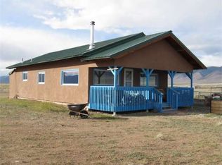
10 Acre Homesite with great access and surrounded by a wide range of recreational opportunities in every direction. The route to the property is all via paved roads. County Road T borders the entire Southern Boundary with 665 feet of road frontage. To the East just 2 miles away is Colorado State Highway 17 that will take you directly to Moffat to the North and Alamosa to the South. Additionally, County Road T leads to US Highway 285 just 10 miles West that will take you directly North to Saguache. Electricity Lines & Poles run along the entire Southern Boundary of the property. There is also a fence running along the entire Eastern Boundary. Moffat is a small town with a population of 119 located 5 minutes away. In Moffat there is the Moffat Consolidated School (Pk-12th Grade), a Post Office, and Fire Department. Saguache has a population of 500 and located just 25 minutes from the property. In Saguache you’ll find a wide range of services & ammenities including a grocery store, restaurants, a park, library, lumber store and professional services. Saguache is also the County Seat of Saguache County. Alamosa has a population of around 8,000 and is located just 40 minutes South of the property via US Highway 285. There is a university in Alamosa, as well as all the services you could find in Saguache then some, but in greater abundance with wider variety. San Luis Regional Airport is also located in Alamosa. The property is surrounded by recreational public lands, including Sand Dunes National Park to the Southeast, Sangre De Cristo National Wilderness & Baca National Wildlife Refuge to the East, and the Rio Grande National Forest to the North, East & West. See Aerial Map Photos & Interactive Map (Located on our Website) for more details. There is no time limit to build. Land owners in the area have developed their properties with homes and outbuildings of varying designs and construction materials, see photos and satellite images of homes near this property. Parcel Size: 10 Acres M/L LANDiO Property ID Number: CO_Saguache_00002 APN: 4599-023-00-005 Legal Description: TRS. 165-166 2-43-9 (SE1/4SW1/4SE1/4) Property Taxes: $16.08 / year Title: Free & Clear Conveyance: Warranty Deed GPS Coordinates: 37.994181, -105.947518 Approximate Distance to Nearby Cities & Points of Interest 2 miles to Moffat, CO 17 miles to Saguache, CO Rio Grande National Forest to the North, East & West Great Sand Dunes National Park to the Southeast Baca National Wildlife Refuge to the Southeast Sangre De Cristo National Wilderness to the East 39 miles to to Alamosa, CO, Population 8,000 39 miles to Monte Vista, CO, Population 4,100 46 miles to Del Norte, CO : Population 1,500 61 miles to South Fork, CO Population 400 80 miles to Wolf Creek Ski Area 154 miles to Colorado Springs, CO : Population 464,000 184 miles to Denver, CO : Population 704,000 GPS Coordinates Northwest Corner: 37.9950257414785, -105.948704579212 Northeast Corner: 37.9949867254548, -105.946394058392 Southeast Corner: 37.9932521752967, -105.946458788692 Southwest Corner: 37.9933390570006, -105.948767778969 Center Point: 37.994181, -105.947518
This property is not currently displayed as for sale or rent on Zillow. This may be different from what's on other websites or public sources.