$1,050 - $1,350
Fees may apply
- Studio+
- 1+ ba
- 430+ sqft
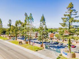
Sierra Apartment Homes
For rent

Use our interactive map to explore the neighborhood and see how it matches your interests.
Casa Loma is a residential neighborhood in southeast Bakersfield, in the flat, inland San Joaquin Valley, where summers are hot and dry and winters are generally mild. Local streets and nearby parks offer open-air recreation, while the wider area connects to Bakersfield’s dining, coffee, shopping, and cultural destinations. The Kern County Museum and downtown arts venues are among the city’s notable attractions, and the Kern River Parkway provides a regional route for walking and biking. Driving is a common way to get around; local bus service offers another option. Rental data for ZIP code 93307, which covers Casa Loma, lists a median rent of $1,700 per month and a typical range of $850 to $2,900.
Powered by Zillow data and AI technology.
Turning Point of Central California is located at 1102 S Union Ave in Casa Loma, Bakersfield, CA. The surrounding area includes multiple restaurants and cafes within 2 miles, such as Carl's Jr., Jack in the Box, and Cafe 1600.
The closest hospitals and medical facilities to Turning Point of Central California include Clinica Sierra Vista (0.7 miles away) and Dr. Malone (1 mile away).
The schools assigned to Turning Point of Central California include Dr. Martin Luther King, Jr. Elementary, Sequoia Middle School, and Del Oro High.
Turning Point of Central California is located near 8 grocery stores, including Watts Market (1 mile) and Fiesta Food Market (1 mile). Additional shopping options, including Floyd's General Store, are approximately 0.9 miles away.
Turning Point of Central California has a walk score of 33, it's car-dependent.
Claiming gives you access to insights and data about this property.