Address: 21st St SW at Franklin Ave, Bandon, OR 97411. 8.96 Acres in Bandon UGB — Planned Crossroads: Hwy 101-to-Beach Corridor & North-South Franklin Greenway Face Rock Heights offers 8.96 contiguous acres west of Hwy 101 inside Bandon's Urban Growth Boundary. Level and substantially cleared, with open ground and mature shore pines throughout and greater tree cover to the west. Five tax parcels under common ownership encompass 154 previously platted residential lots. Parcel IDs: 28S-1536AD 03301, 28S-1536AC 02300, 28S-1536AC 03100, 28S-1536AC 02200, 28S-1536AC 02101. Zoned Coos County UR-2; future annexation and rezoning require approvals. Existing highway access is a major advantage: County-permitted 21st St SW is a 20-ft-wide, two-way gravel road from Hwy 101 at Mile Marker 275, extending roughly 200 ft into the property area. The site lies at the planned crossroads of east-west 21st St SW toward Face Rock Road and Beach Loop, and the north-south Franklin Avenue Greenway. In March 2026, Gravel Point outlined plans to use 21st St SW for construction access, with later upgrades to City standards. Corridor plans envision city water, sewer, related utilities and a pedestrian/bicycle pathway. Timing and work remain subject to approvals. Existing improvements include a homestead with a 1996 Fleetwood manufactured home offered as-is, gravel driveway with large-vehicle hammerhead turnaround, well, septic, underground electric service, cable and six shipping containers. Primary value lies in the land, location and long-term connectivity potential. Face Rock State Scenic Viewpoint and beach access are nearby. If the planned connection is completed, a 21st St SW route could offer an approximately one-half-mile beach walk. Adjacent 5.22 acres offered separately could allow a 14.18-acre assemblage, subject to availability. Buyers should verify access status, uses, boundaries, utilities, costs and feasibility. Sources: City of Bandon 2025 TSP; The World, Mar. 17, 2026.
Active
$2,250,000
21st St, Bandon, OR 97411
--beds
0baths
8.96Acres
Unimproved Land
Built in ----
8.96 Acres Lot
$-- Zestimate®
$--/sqft
$-- HOA
What's special
Level and substantially clearedOpen groundMature shore pines throughout
- 20 days
- 83
- 0
Zillow last checked:
Listing updated:
Listed by:
Jared English 888-881-4118,
Congress Realty
Source: RMLS (OR),MLS#: 413618349
Facts & features
Interior
Bedrooms & bathrooms
- Bathrooms: 0
Video & virtual tour
Property
Features
- Has view: Yes
- View description: Mountain(s), Pond, Trees/Woods
- Has water view: Yes
- Water view: Pond
Lot
- Size: 8.96 Acres
- Dimensions: Appro x . 1,118 x 480
- Features: Cleared, Corner Lot, Cul-De-Sac, Pasture, Trees, Level, Acres 7 to 10
Details
- Additional structures: Existing Structures, MobileHome
- Additional parcels included: 2399100
- Parcel number: 99918261
- Zoning: UR-2
Utilities & green energy
- Sewer: Septic Tank
- Water: Well
- Utilities for property: Cable Connected, Electricity Connected
Community & HOA
HOA
- Has HOA: No
Location
- Region: Bandon
Financial & listing details
- Annual tax amount: $1,979
- Date on market: 10/16/2026
- Listing terms: Cash,Owner Will Carry,Seller Equity Share
- Road surface type: Gravel
Estimated market value
Not available
Estimated sales range
Not available
Not available
Price history
| Date | Event | Price |
|---|---|---|
| 10/16/2026 | Listed for sale | $2,250,000 |
Source:  RMLS (OR) #413618349 Report a problem | ||
Public tax history
Tax history is unavailable.
Monthly payment
Climate risks
Neighborhood: 97411
Nearby schools
Schools provided by the listing agent
- Elementary: Ocean Crest
- Middle: Harbor Lights
- High: Bandon
Source: RMLS (OR). This data may not be complete. We recommend contacting the local school district to confirm school assignments for this home.


Similar homes
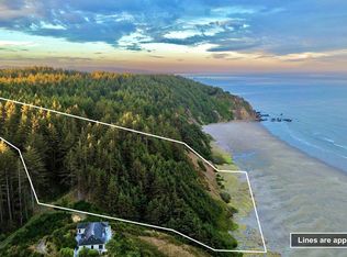
- $2,395,00027.2 acres00-1807 Agate Ln, Bandon, OR 97411Active

 MLS ID #627929837, Sadena Abell, Pacific Coast Real Estate & Development, LLC. RMLS (OR)
- $1,500,0004.2 acres88300 Pacific Surf Ln, Bandon, OR 97411Active
 MLS ID #264254163, Gary Trenner II, Coastal Sotheby's International Realty. RMLS (OR)
- $2,995,00017.56 acres88184 Ocean Estates Rd, Bandon, OR 97411Active
 MLS ID #139502875, Jody Tatone, RE/MAX Integrity. RMLS (OR)
- $1,295,0000.42 acres54190 Gould Rd, Bandon, OR 97411Active
 MLS ID #326411191, Hunter Finch, Coastal Sotheby's International Realty. RMLS (OR)
